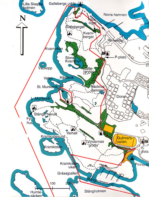
| Map over the Stångehuvud area | |
 |
|
|
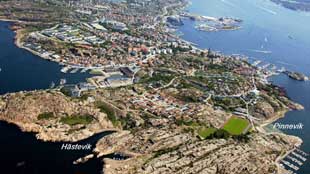
Aerial
photo over Stångehuvud
Aerial
photo over Stångehuvud
|
|
|
See also Arial
photo map
|
| Map over the Stångehuvud area | |
|
|
|
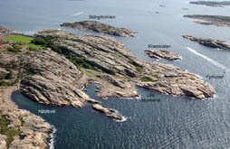
Aerial
photo over Stångehuvud
Aerial
photo over Stångehuvud
|
|
|
See also Arial
photo map
|